Iowa Highway 52

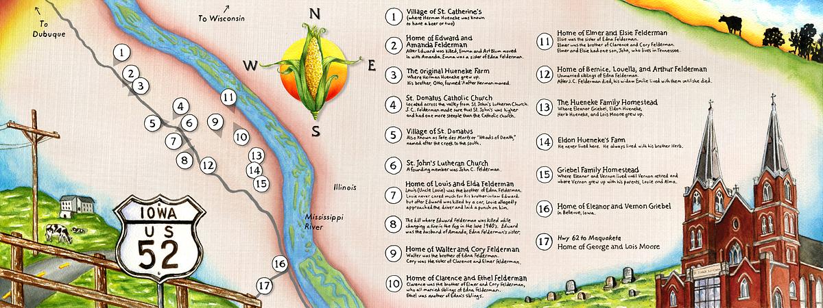
This is a map of Iowa Highway 52, where during the late 19th century and early to mid 20th century, my father's ancestors all had homesteads or farms. After my dad would spend every road trip pointing out each location and telling stories about all the people who once lived there, I decided to write everything down and record the history with a map. The church pictured at right is St. John's Lutheran Church, where my great grandfather was a founding member and where most of these people are buried.