Chicago Typography Aerial Skyline

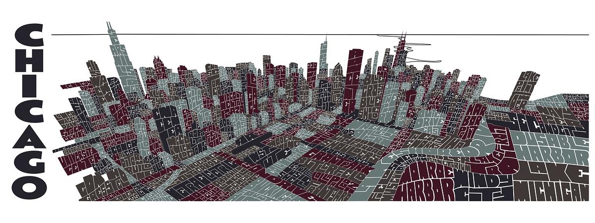
This map uses an aerial view of Chicago to capture as much of the architecture in the Loop and around Grant Park as possible. Over 250 buildings, streets, sculptures, parks and landmarks are represented in this illustration.